


1er Rando Innsbruck

patign
User
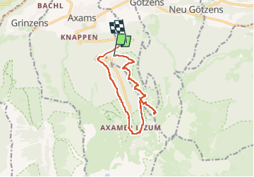

Length
12 km

Max alt
1972 m

Uphill gradient
650 m
Km-Effort
21 km

Min alt
1209 m

Downhill gradient
808 m
Boucle
No
Creation date :
2025-05-12 07:47:15.0
Updated on :
2025-05-12 13:43:50.669
3h29
Difficulty : Medium

FREE GPS app for hiking
 SityTrail
IGN / Geographical institutes
SityTrail Plus
The world is yours!
About
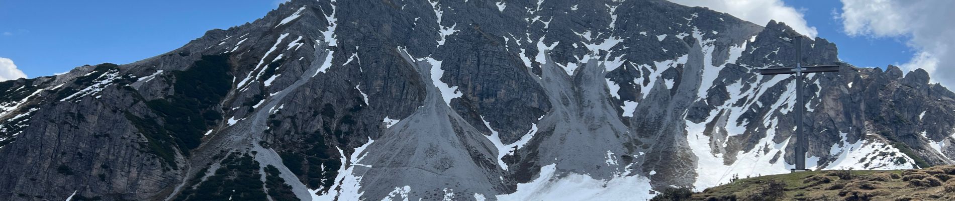
Trail Walking of 12 km to be discovered at Tyrol, Bezirk Innsbruck-Land, Gemeinde Birgitz. This trail is proposed by patign.
Photos


Positioning
Country:
Austria
Region :
Tyrol
Department/Province :
Bezirk Innsbruck-Land
Municipality :
Gemeinde Birgitz
Location:
Unknown
Start:(Dec)
Start:(UTM)
673751 ; 5231947 (32T) N.
Comments